We are a multi-disciplinary team of 20 people, consisting of professors, students and specialist professionals from two Schools at the UPM (HTSE for Topography, Geodesy and Cartography and HTSE for Information Systems) and other external research bodies. We are members of numerous research bodies: el Centro GEOI+D; the Geographic Information Technologies Laboratory (LatinGEO); two clusters at the Moncloa IEC, Global Change and New Energy and Cultural Heritage; and GeoAlerta, which is one of the UPM's Cooperation Groups.
Site card
MERCATOR: Geoinformation and Smart Systems Technology
MERCATOR
Structure: Research Groups
The group's members carry out their work in fields linked to geographical information and smart systems with soft-computing on the following lines of research:
- Spatial Data Infrastructures (SDI) and GIS.
- Localisation- Based Services Engineering (LBS) and Smart Control.
- Modelling and managing large Space/time databases: climate, meteorological, tourist and cadastral.
- Voluntary Geographic Information incentive and use.
- Information agents, neural networks, evolutionary computation, fuzzy logic, recommendation systems, Bioinspired and Artificial Life systems.
- Service engineering for intelligent localization and control
- Spatial Data Infrastrcutures (SDI)
- Spatial-temporal modeling
- Temporal data management with GIS
Our research group is a recognised member of the OGC (Open Geospatial Consortium) and AGILE (Association of Geographic Information Laboratories in Europe), and our research work focusses on real projects, specialist training, consultancy and technology transfer in the field of Geographic Information Technologies (GIT) and other similar technologies.
Amongst other research we have recently carried out, a highlight is Virtual Spain, a project within the Ingenio 2010 programme, with the National Geographic Institute (IGN), directed at creating a bridge between the geographic world and Internet technologies. Another highlight is participation in the thematic network ENERGIC (ICT COST - IC1203) on CrowdSourcing Geographic Information.
The group has also collaborated with:
- the National Geographic Institute in the field of Spain's Toponymy, in the tasks of design and quality control of the Basic Geographic Nomenclature for Spain, and in the tasks of its comparison and standardisation with the nomenclature of the various regional communities;
- with Red Eléctrica de España, on designing and developing tools facilitating space and document management work for the effect of new installations on the land, developing software that has been registered and is in use.
- with Telefónica and Filmaffinity, developing information recovery and recommendation software.
The group has a commitment to cooperating in development with Latin America. It has driven the creation of the LatinGeo Network (GIT Laboratories network), taking part in the CYTED IDE project i Latin American and the Caribbean and several AECID projects.
Have a look at our new lines of research:
- systems control using brain waves, for example: "brain music".
- BigData applied to nowcasting prediction of solar radiation and probability of lightning strikes.
Showing all 3 results
-
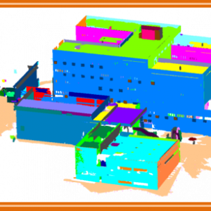
Automatic modelling software for architectural environments
-

Perfect hearing. Audio device that boosts the listener’s audiometric response to achieve perfect hearing.
-

Software description 1. Computer program description. This application, which is also provided as an API, is capable of processing numerical or enumerated ratings databases that…